


castejon de Sos - sos - liri - aurensan - castejon de sos

Forsans
User
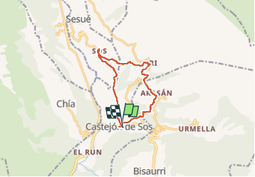

Length
11.9 km

Max alt
1300 m

Uphill gradient
445 m
Km-Effort
17.9 km

Min alt
907 m

Downhill gradient
445 m
Boucle
Yes
Creation date :
2025-04-27 07:37:37.227
Updated on :
2025-05-09 16:45:42.925
5h27
Difficulty : Medium

FREE GPS app for hiking
 SityTrail
IGN / Geographical institutes
SityTrail Plus
The world is yours!
About
Trail Walking of 11.9 km to be discovered at Aragon, Huesca, Castejón de Sos. This trail is proposed by Forsans.
Description
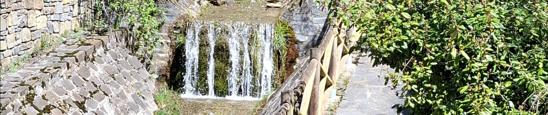
belle rando et beau villages
Photos


Positioning
Country:
Spain
Region :
Aragon
Department/Province :
Huesca
Municipality :
Castejón de Sos
Location:
Unknown
Start:(Dec)
Start:(UTM)
294048 ; 4709745 (31T) N.
Comments